Global Positioning System and 365Fleet Features
The Global Positioning System (GPS), originally Navstar GPS, is a space-based radionavigation system owned by the United States government and operated by the United States Air Force. It is a global navigation satellite system that provides geolocation and time information to a GPS receiver anywhere on or near the Earth where there is an unobstructed line of sight to four or more GPS satellites.
The GPS system does not require the user to transmit any data, and it operates independently of any telephonic or internet reception, though these technologies can enhance the usefulness of the GPS positioning information. The GPS system provides critical positioning capabilities to military, civil, and commercial users around the world. The United States government created the system, maintains it, and makes it freely accessible to anyone with a GPS receiver. However, the US government can selectively deny access to the system, as happened to the Indian military in 1999 during the Kargil War.
The GPS project was launched in the United States in 1973 to overcome the limitations of previous navigation systems, integrating ideas from several predecessors, including a number of classified engineering design studies from the 1960s. The U.S. Department of Defense developed the system, which originally used 24 satellites. It became fully operational in 1995. Roger L. Easton of the Naval Research Laboratory, Ivan A. Getting of The Aerospace Corporation, and Bradford Parkinson of the Applied Physics Laboratory are credited with inventing it.
Advances in technology and new demands on the existing system have now led to efforts to modernize the GPS and implement the next generation of GPS Block IIIA satellites and Next Generation Operational Control System (OCX). Announcements from Vice President Al Gore and the White House in 1998 initiated these changes. In 2000, the U.S. Congress authorized the modernization effort, GPS III.
In addition to GPS, other systems are in use or under development, mainly because of a potential denial of access by the US government. The Russian Global Navigation Satellite System (GLONASS) was developed contemporaneously with GPS, but suffered from incomplete coverage of the globe until the mid-2000s. GLONASS can be added to GPS devices, making more satellites available and enabling positions to be fixed more quickly and accurately, to within two meters. There are also the European Union Galileo positioning system, China's BeiDou Navigation Satellite System, India's NAVIC and Japan's Quasi-Zenith Satellite System. From wikipedia
365Fleet Features
- Real-Time Tracking
- Notifications
- History and Reports
- Fuel Savings
- Geofencing
- POI & Tools
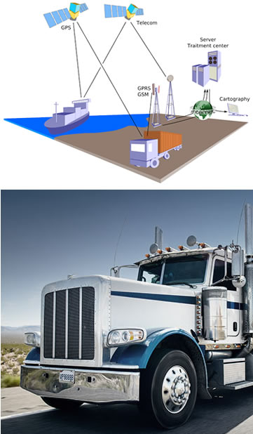
Real-Time Tracking
Track the location of your objects (vehicle) online in real-time. Choose from the following maps: Google, Satellite, OSM etc. View additional information about the tracking objects: speed, exact address, petrol consumption, travel history etc.
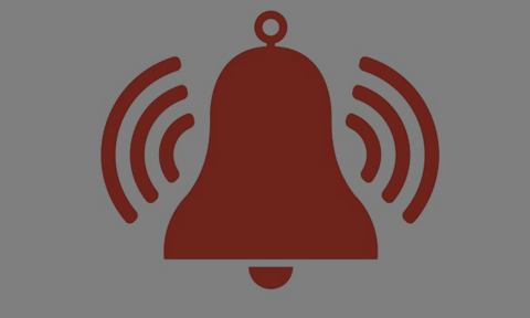
Notifications
Get instant alerts about your tracking object: know when the object enters or exits geo-zone, know if it is speeding and stopovers. Get SOS alarms if it has been stolen as well as turn on/off the engine easily.
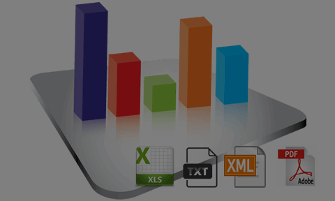
History and Reports
Download and review reports in different formats: XLS, PDF, CSV, TXT. Reports include various information by date and GPS tracker name including: driving hours, stopovers, distance traveled, fuel consumption and many more. Detailed and group reports are also available.
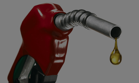
Fuel Savings
Easily check tank fuel level and fuel consumption along the route in real time. Aggressive driving: rapid acceleration, speeding and braking, directly influencing fuel consumption. It is a fact, that improving driving behavior can cut your fuel costs significantly (by 5% to 15%). Moreover, fuel consumption control is a great preventive measure against fraud.
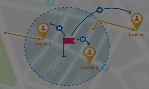
Geofencing
Geofence feature allows to set up geographic boundaries around areas that have specific interest for you. Receive automated alerts when the object enters or leaves marked boundaries.
POI & Tools
With Points of Interest (POI) tool you can add markers at the locations, such as: gas station, a hotel, a restaurant, etc. Also, you can name the place and add description. You can also use tools for calculating distances between places on the map.